Upper Middle Rhine Valley
 |
| Castles at Kaup, picture: A.Murmann CC BY-SA 4.0 |
 |
|
Picture:
A.Murmann CC BY-SA 4.0 |
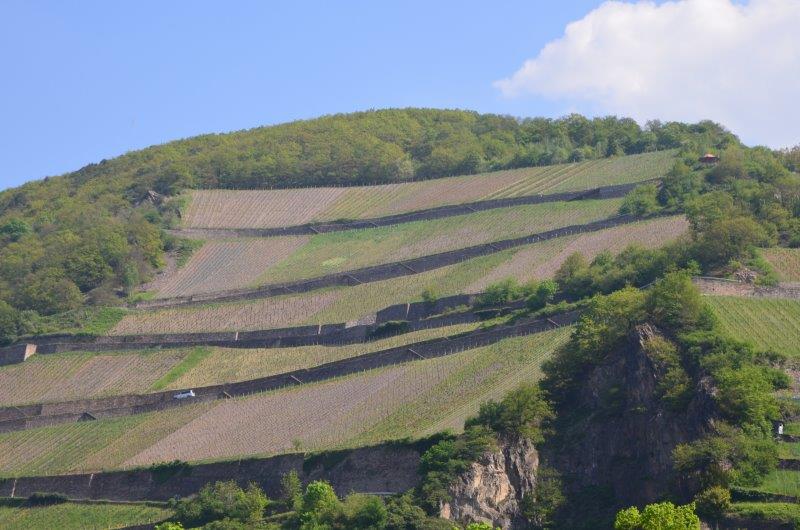
The valley is an exceptional cultural landscape, whose present state is determined on the one hand by the geomorphological and geological conditions found here and on the other hand by human intervention - such as the construction of settlements, traffic routes and land use (criterion iv). Even today, the Upper Middle Rhine Valley is an example of a continuing development of traditional settlement methods in a narrow river valley. In particular, the transformation of the profile of the steep slopes into a terraced landscape has shaped the landscape over the last two thousand years (criterion v).
With its vine-covered valley slopes, the settlements pushing their way to the narrow banks and the numerous high-altitude castles and fortresses, the valley is regarded as the symbol of the romantic Rhine landscape. Writers, painters and composers from all over the world have been inspired by it. Especially during the 19th century (Romantic period) numerous castles were restored and rebuilt.
The World Heritage Site stretches from the Bingen Gate, where the Rhine flows through a deep, narrow gorge, to Koblenz. The Rhine passes some narrow places - the best known is at the Loreley rock near St. Goar. The middle and upper Rhine terraces of the upper valley, which traces the earlier course of the river, also belong to the World Heritage.
No comments:
Post a Comment